EuroVelo 1 enters Navarre along the Bidasoa Greenway. From Endarlatsa, passing through Bera to Doneztebe/Santesteban, this disused railway section crosses magnificent landscapes of green meadows dotted with farmhouses, picturesque tunnels, typical villages and even a forgotten bunker. An easy and pleasant route, with a practically flat profile. In the town of Sunbilla is the Ariztigain Camping which is reached after a short walk.
In the valley of Malerreka, flanked by several mountains such as Mendaur, the elegant village of Doneztebe/Santesteban is sheltered, from where the route starts towards the Basaburua Valley, to finally reach Irurtzun, where, next to the dam, one of the sections of the Plazaola Greenway ends. At Latasa there is the option of turning off the route and continuing along the Plazaola Greenway to the Aralar Campsite located in Lekunberri.
The route continues through the municipality of Iza and at the height of Añezcar takes a detour that leads to Camping Ezcaba leaving the official route for a few kilometers. From the campsite, take the Arga river walk to access Pamplona-Iruña.
From Pamplona-Iruña its route continues towards Estella-Lizarra along the route of the Camino de Santiago, also coinciding with the EuroVelo 3. An itinerary full of street villages, medieval bridges, great monuments, landscapes that change color with each season, wineries and high quality gastronomy. Camping Lizarra is located in the surroundings of Estella-lizarra.
Just outside Estella-Lizarra, the Iratxe Monastery awaits and next to it, the Iratxe Campsite. Further on, the rock castle of Villamayor de Monjardín is left behind and the route reaches Los Arcos, Torres del Río and finally Viana, which, elevated on a hill, looks placidly towards the horizon, towards Álava and La Rioja.
For this route we can rely on five campsites; Ariztigain, Aralar, Ezcaba, Lizarra and Iratxe. The distance between the entrance to Navarra and Camping Ariztigain is 25.7 km, between Camping Ariztigain and Camping Aralar there are 61.9 km, between Camping Aralar and Camping Ezcaba there is a distance of 36 km, between Camping Ezcaba and Camping Lizarra 68.2 km, between Camping Lizarra and Camping Iratxe there are only 7 km and between the latter and the border of Navarra with La Rioja there are 44.9 km to go.
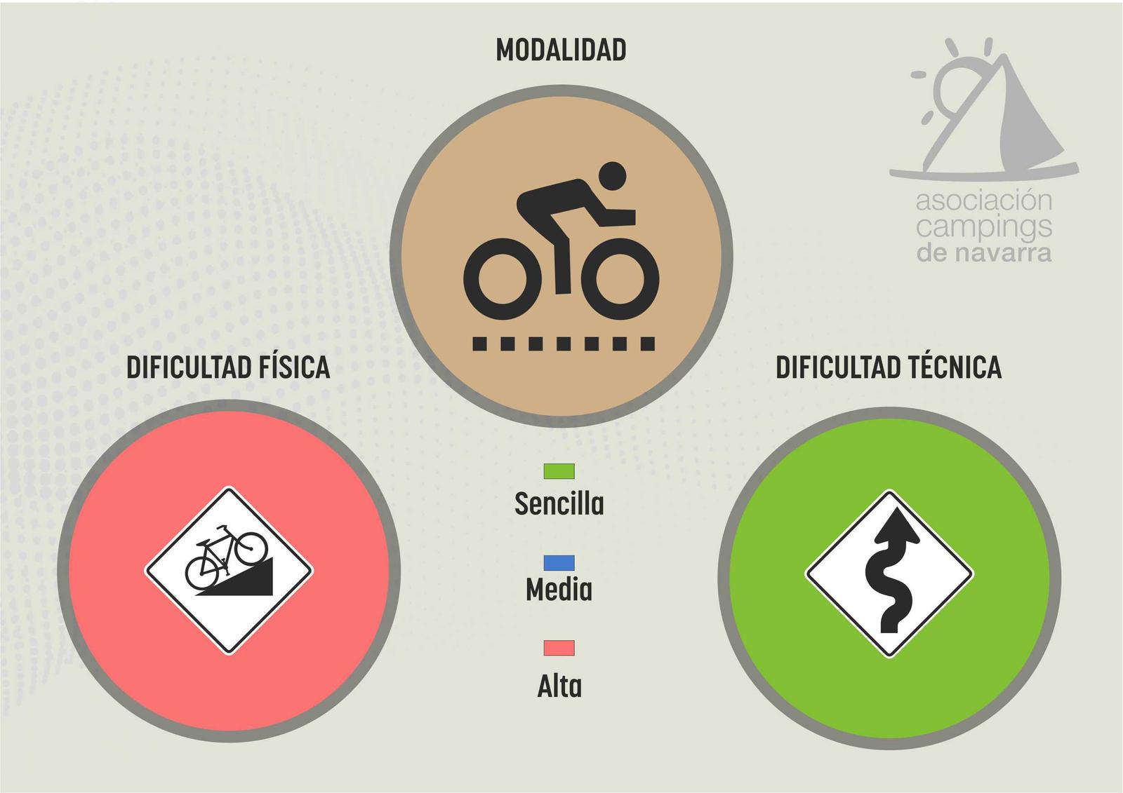
We propose the use of gravel or MTB bikes but not road bikes because there are many dirt sections.
(Text: Tourism Navarra)